


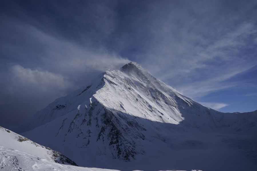
Photo taken on May 11, 2020 shows that clouds swirl around the Mount Qomolangma. (Xinhua/Tashi Tsering)
by Zhou Shengping, Prithvi Shrestha
KATHMANDU, May 23 (Xinhua) -- It was 3:00 a.m. local time on May 22 last year when Khim Lal Gautam, 36, a Nepali survey officer reached the top of Mount Qomolangma, where he and his colleague spent 105 minutes on a mission to measure the height of the world's tallest mountain, the first try in Nepal's history.
As the team leader, Gautam and another team member had to take necessary data with ground-penetrating radar (GPR) to check the depth of ice and snow covering the rock, and a top-of-the-line satellite navigation device (Global Navigation Satellite System receiver) for receiving necessary signals from the satellites.
It's the second time for Gautam to climb the peak. In 2011, he became the first survey professional in Nepal to scale Mount Sagarmatha, the Nepali name of Mount Qomolangma. As a pure mountaineer, he and other eight team members spent 15 minutes on the world's highest peak looking over the mountain, taking photos and listening to music.
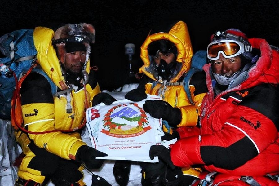
Khim Lal Gautam (L) and other members on the top of Mt. Qomolangma on May 22, 2019. (Photo by Tshiring Jangbu Sherpa/Xinhua)
Compared to the first relatively relaxed expedition, the second time was more tough and risky. Spending so long on the top, he felt dizzy for being exposed to the thin air and the cold environment.
"We had shouldered responsibility, we didn't get time to enjoy the moment," Gautam said to Xinhua over telephone from western Pokhara city where he is in charge of a survey office.
"In fact, I only had a group photograph but not a single photograph taken," said Gautam, who has joined the survey industry for 16 years.
The worst part was that carrying a heavy load took toll on Gautam as his socks were wet due to sweating. The sweat became ice and damaged his big toe on the left foot so seriously that after returning from the peak, he could not wear shoes for eight months.
"I travelled to China, Australia, Thailand and India by wearing a pair of sandals to the surprise of many friends there," said Gautam. After the toe mostly recovered with the nail still absent, he started to wear shoes four months ago.
Khim Lal Gautam(L) and other members on the top of Mt. Qomolangma on May 22, 2019. (Photo by Tshiring Jangbu Sherpa/Xinhua)
"I have no regret for losing my small body part because it's a matter of pride for me to be able to lead the expedition team."
While porters helping the expedition team by carrying extra oxygen went down ahead of the survey team, they thought the survey team had already climbed down. But a member of the expedition team had run out of oxygen. "I had managed the oxygen for him from other climbers," said Chhiring Jangbo Sherpa, a team guide in the measurement expedition team, adding that due to the crowds of climbers, the porters had failed "to identify us properly and it happened very often."
Based on the data collected by his team from the top of the mountain along with other field data, the Department of Survey, which is tasked to measure the height of Mount Qomolangma, is now in the final process of determining the height of the world's tallest mountain.
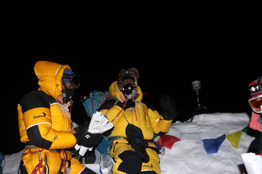
Khim Lal Gautam and another surveyor Rabin Karki working on the top of Mt. Qomolangma on May 22, 2019. (Photo by Tshiring Jangbu Sherpa/Xinhua)
"After completing all the field works, we are in the process of data analysis," said Sushil Dangol, coordinator at Nepal's measurement secretariat under the department. "The data analysis process is taking more time due to the ongoing lockdown in Nepal to curb the spread of the COVID-19."
The Nepali government's efforts to measure the height of Mount Qomolangma come amid speculations from some scientists that the world's tallest mountain has shrunk after the devastating earthquake in 2015.
Although expedition teams from various countries have measured the altitude of the mountain for five times and produced diverse results in the past, Nepal has never become part of those teams.
As Nepal is in the final phase of the measurement process, China has also sent a survey team as part of the country's mission to remeasure the height of the world's highest mountain. Gautam wished success for his Chinese colleagues on their mission. ■
