


China's continuous efforts to explore the Yangtze's headwaters began in the mid-1970s. Treking more than 300,000 km in decades of expeditions to the hinterland of the "Earth's third pole", Chinese researchers have captured an ever clearer picture of how to protect the ecosystem where their mother river rises from.
XINING, Sept. 2 (Xinhua) -- Meandering rivers snake off into the distance from lofty snow mountains on the Qinghai-Tibet Plateau, where antelope sporadically appear on marshy grasslands.
What stands behind the magnificent highland scenery is a highly complicated ecosystem -- too fragile to restore if damaged.
On Aug. 4, more than 20 experts from the country's water conservation departments and scientific research institutions set foot on the hinterland of the "Earth's third pole" for the latest expedition to the Yangtze River's headwater region. The 6,300-km-long river, called Changjiang in Chinese, is China's longest and the world's third longest river, next to the Amazon and Nile.
They trudged nearly 4,000 km during the weeklong survey at an average altitude of more than 4,000 meters, carrying out hydrologic and landform surveys, and research on the ecological environment of fish habitats.
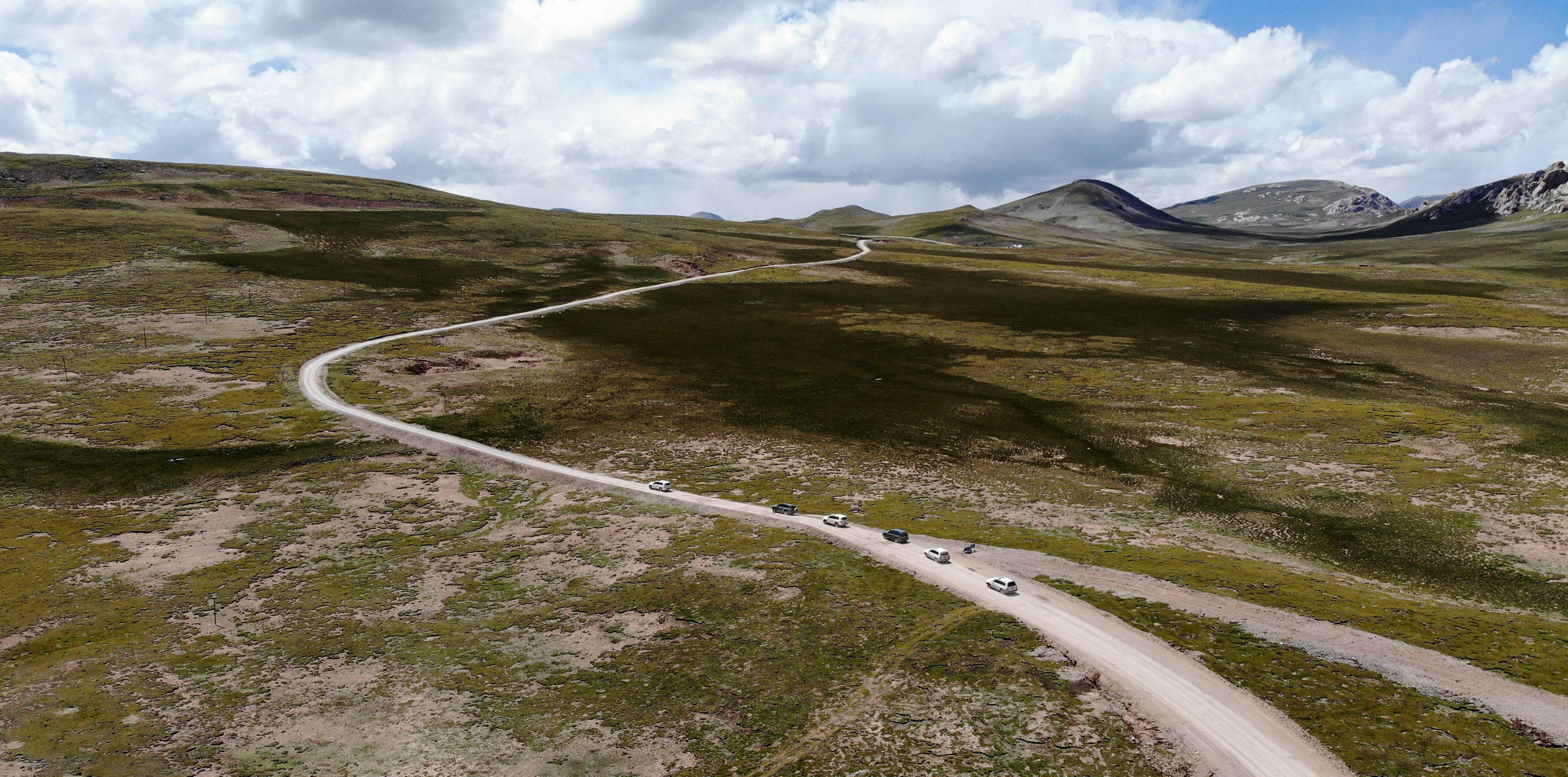
Aerial photo taken on Aug. 8, 2019 shows vehicles of the researchers of the Changjiang River Scientific Research Institute (CRSRI) running on the road in Zhidoi County, Yushu Tibetan Autonomous Prefecture, northwest China's Qinghai Province. (Xinhua/Wu Gang)
DR. "FISHERMAN"
Li Wei, 34, has become inured to camping in the frozen wild after his car broke down on a snow-covered roadside where the temperature dipped below minus 30 degrees Celsius.
As a PhD researcher at the Changjiang River Scientific Research Institute (CRSRI) of the Changjiang Water Resources Commission and the only team member who specializes in highland cold-water fish, he eventually unveiled the secrets of how the fish there survive winter.
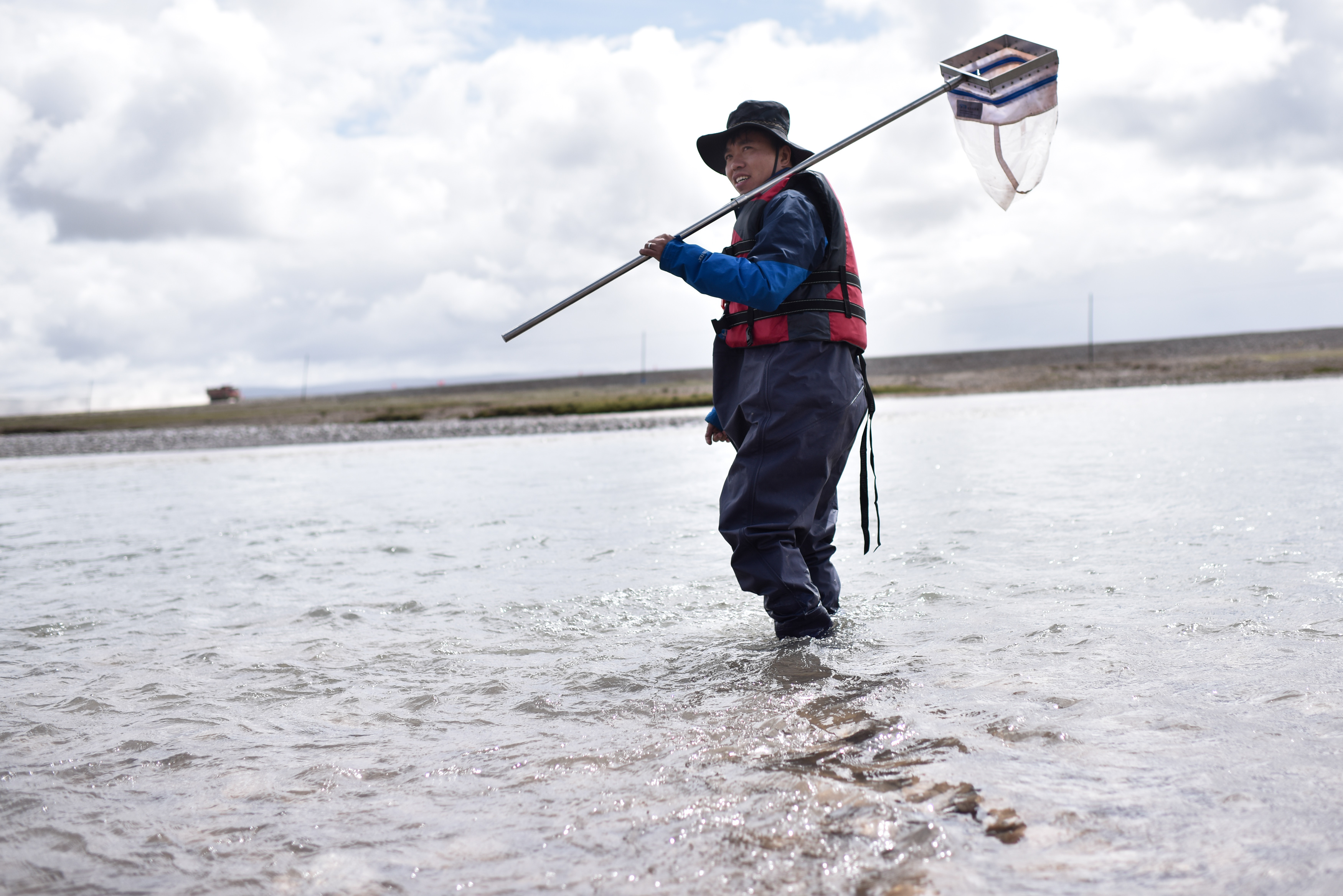
Li Wei, a researcher of the Changjiang River Scientific Research Institute (CRSRI), collects fish samples in Zhidoi County, Yushu Tibetan Autonomous Prefecture, northwest China's Qinghai Province, Aug. 8, 2019. (Xinhua/Wu Gang)
"The cruelty of nature did scare me with its roaring chilly blasts and carpenter bee stings," Li said with a running nose.
Since 2012, the CRSRI has carried out eight comprehensive scientific expeditions to the Yangtze's headwaters, providing considerable first-hand data for the protection of the Yangtze River and the construction of Sanjiangyuan National Park.
It was Li's fifth research tour to the region in less than two years, earning the nickname "Dr. Fisherman" for his skill in casting his net and catching samples.
The research team found the location of the overwintering ponds, spawning sites and feeding areas of highland fish, as well as their formation mechanism.
"It is of great significance to restore the fish population by artificial propagation and releasing," Li said.
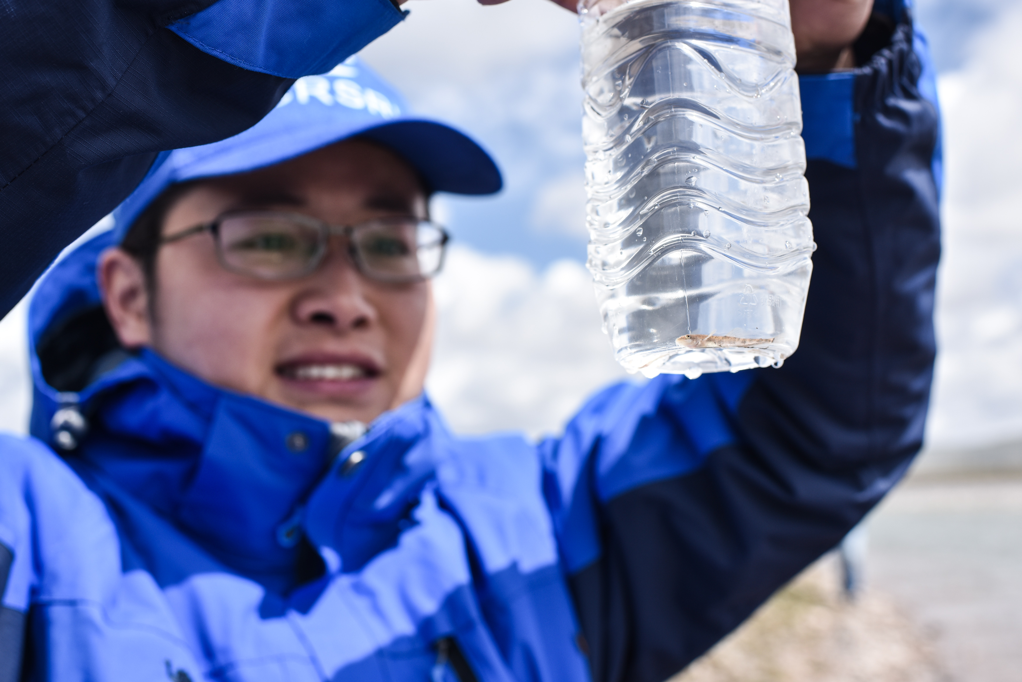
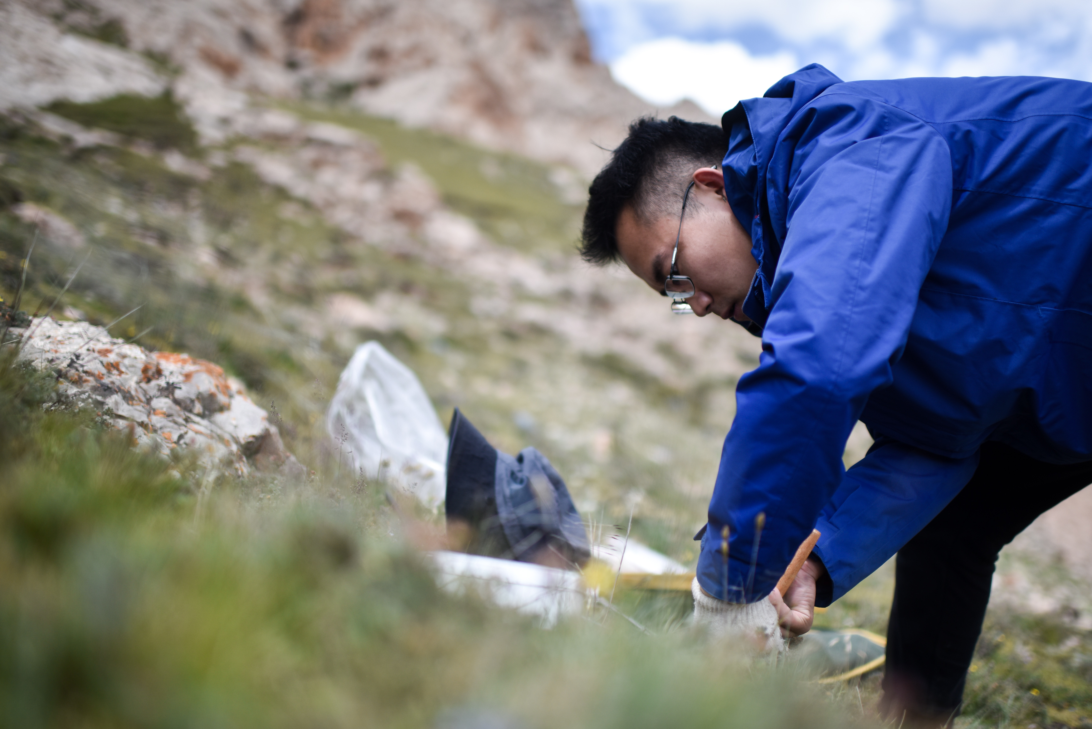
Gao Zhiyang, a researcher of the Changjiang River Scientific Research Institute (CRSRI), collects samples in Zhidoi County, Yushu Tibetan Autonomous Prefecture, northwest China's Qinghai Province, Aug. 8, 2019. (Xinhua/Wu Gang)
THE "PHYSICAL EXAM"
Vegetation ecological survey was a key part of the expedition, with plant composition and height, species abundance, cover degree and other habitat indexes in every quadrat carefully recorded.
"If we compare a watershed ecosystem to a human body," said Ren Feipeng with the CRSRI, "then vegetation is the hair while the soil is the skin."
There was meadow degradation, even desertification in some parts of the region, Ren added, noting that the eco-regulation has been weakened due to rising temperature, worsening drought and disturbing human activities.
Research on the soil environment showed that the soil there develops slowly due to complicated atmospheric circulation and extremely cold climate. The alpine meadow soils have grown up to only 15-20 cm since the uplift of the Qinghai-Tibet Plateau.
Aerial photo taken on Aug. 8, 2019 shows vehicles of the researchers of the Changjiang River Scientific Research Institute (CRSRI) running on the road in Zhidoi County, Yushu Tibetan Autonomous Prefecture, northwest China's Qinghai Province. (Xinhua/Wu Gang)
China's continuous efforts to explore the Yangtze's headwaters began in the mid-1970s as 28 scientists started their journey in July 1976 -- sometimes on trucks, sometimes on horseback or simply on foot.
Trekking more than 300,000 km in decades of expeditions to the Yangtze headwaters, Chinese research teams have not only accumulated a large amount of valuable scientific data, but cultivated a group of talented young professionals, said CRSRI's deputy chief engineer Xu Ping.
PROTECTING MOTHER RIVER
The latest expedition shows that the ecosystem of the Yangtze's headwater region, praised as the "water tower" of China, is in an overall good condition, while the challenges it faces should not be underestimated.
Climate change, soil degradation and the impact of human activities have brought negative effects to the region, which lead to melting glaciers, reducing vegetation, declining biodiversity and pollution.
Sun Baoyang, a researcher of the Changjiang River Scientific Research Institute (CRSRI), collects samples in Zhidoi County, Yushu Tibetan Autonomous Prefecture, northwest China's Qinghai Province, Aug. 8, 2019. (Xinhua/Wu Gang)
Wu Zhiguang, Party chief of the CRSRI, said water ecology plays a vital role in balancing nature, a life community of mountains, rivers, forests, farmlands, lakes and grasslands.
Scientific expeditions in the Yangtze's headwater region have turned into a brave and ongoing fight to protect the source of the great river.
"By taking a closer look at the headwaters, we can better safeguard it," Wu said.
(Video reporters: Wu Gang; Video editor: Yin Le)
