


BEIJING, Dec. 15 (Xinhua) -- Drones take us to review stunning scenery across China, with notable aerial photos taken by Xinhua photographers in 2020.

Aerial photo taken on Nov. 10, 2020 shows a view of the Aha Lake National Wetland Park in Guiyang, southwest China's Guizhou Province. (Xinhua/Ou Dongqu)
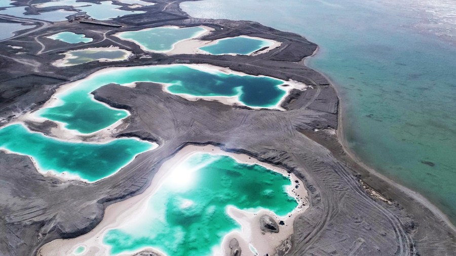
Aerial photo taken on Oct. 30, 2020 shows a view of the Feicui Lake in Haixi Mongolian and Tibetan Autonomous Prefecture, northwest China's Qinghai Province. (Xinhua/Zhao Yuhe)

Aerial photo taken on Sept. 24, 2020 shows a farmer airing herbs at Jihong Village in Jingyu County, northeast China's Jilin Province. (Xinhua/Zhang Nan)
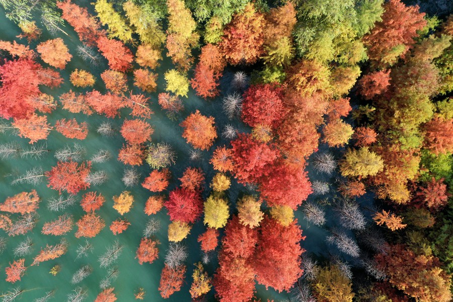
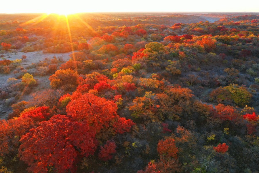
Aerial photo taken on Nov. 2, 2020 shows a view of a dawn redwood forest in Zhanghe Reservoir of Jingmen City, central China's Hubei Province. (Photo by Peng Qi/Xinhua)

Aerial photo taken on June 29, 2020 shows farmers fertilizing gorgon fruit at Chahe Town of Huai'an City, east China's Jiangsu Province. (Photo by Wan Zhen/Xinhua)
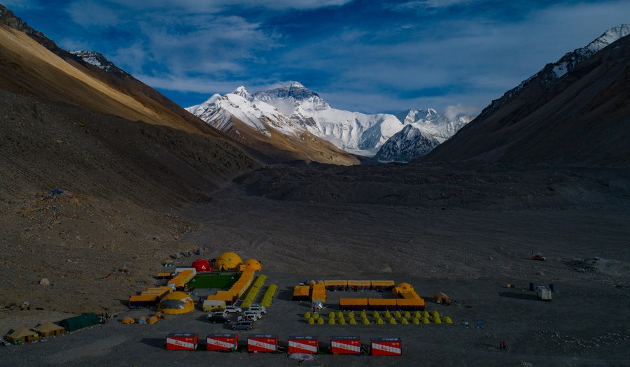
Aerial photo taken on May 25, 2020 shows a view of the Mount Qomolangma base camp. (Xinhua/Purbu Zhaxi)

Aerial photo taken on Sept. 2, 2020 shows tourists spending time in a field of pink muhly grass at Shenquangu scenic area in Changshun County of southwest China's Guizhou Province. (Xinhua/Tao Liang)
Aerial photo taken on Aug. 16, 2020 shows the Tuotuo River, a source of the Yangtze River, in northwest China's Qinghai Province. (Xinhua/Wu Gang)
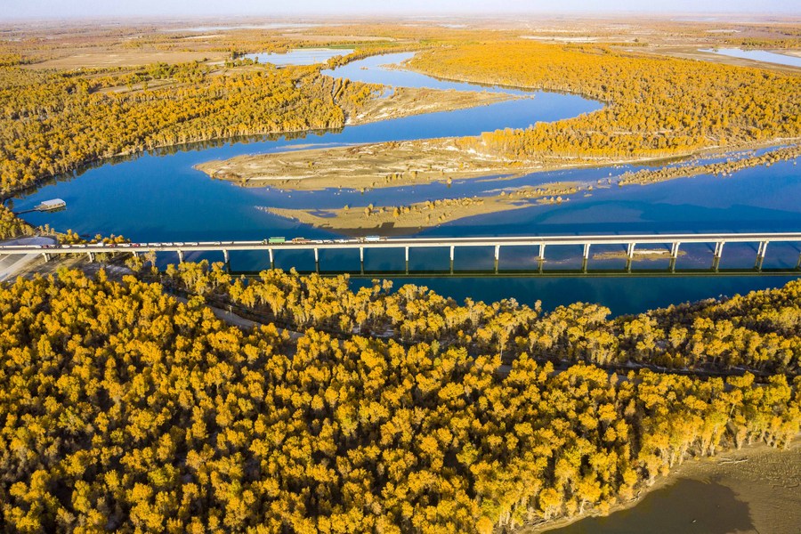
Aerial photo taken on Oct. 22, 2020 shows the autumn scenery of desert poplar forest along the Tarim River in Xayar County, northwest China's Xinjiang Uygur Autonomous Region. (Xinhua/Hu Huhu)

Aerial photo taken on June 24, 2020 shows the Nishui Liugui Village Fortress in Humen Township of Dongguan City, south China's Guangdong Province. (Xinhua/Liu Dawei)
Aerial photo taken on June 10, 2020 shows a view of a wetland park in Taxkorgan Tajik Autonomous County, northwest China's Xinjiang Uygur Autonomous Region. (Xinhua/Hu Huhu)
Aerial photo taken on Oct. 18, 2020 shows rice fields in Jiangzhuang Village of Luanzhou City, north China's Hebei Province. (Xinhua/Mu Yu)
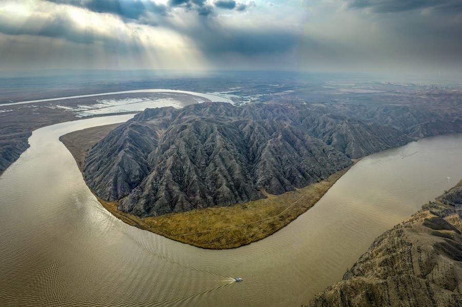
Aerial photo taken on April 5, 2020 shows the scenery of Qingtongxia Grand Canyon of the Yellow River in Qingtongxia City, northwest China's Ningxia Hui Autonomous Region. (Xinhua/Feng Kaihua)
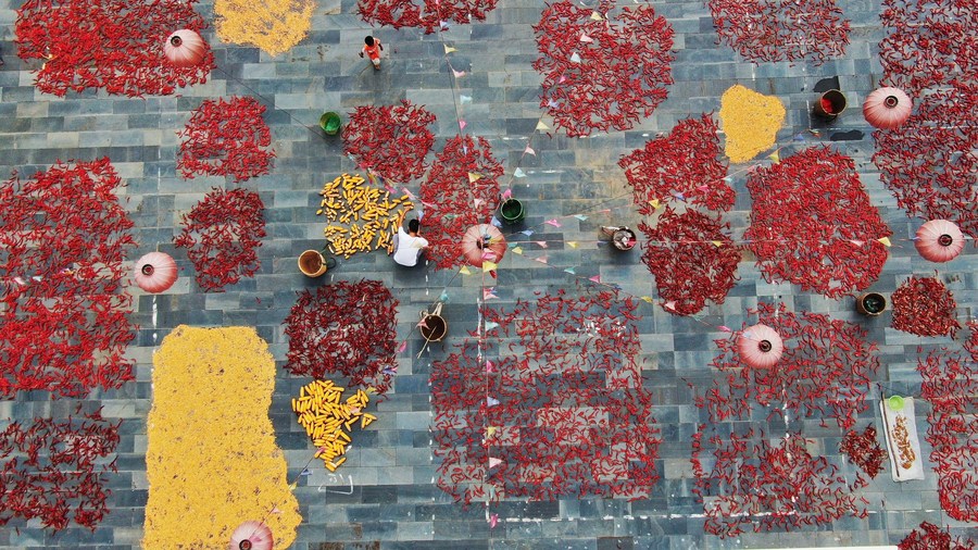
Aerial photo taken on Aug. 15, 2020 shows villagers airing crops in Xiudong Village of Jinping County, southwest China's Guizhou Province. (Photo by Yang Xiaohai/Xinhua)
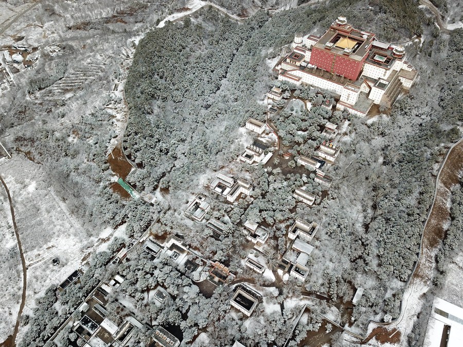
Aerial photo taken on Nov. 19, 2020 shows a view of the snow-covered Putuo Zongcheng Temple, also known as "the Little Potala Palace," in Chengde City, north China's Hebei Province. (Photo by Wang Liqun/Xinhua)
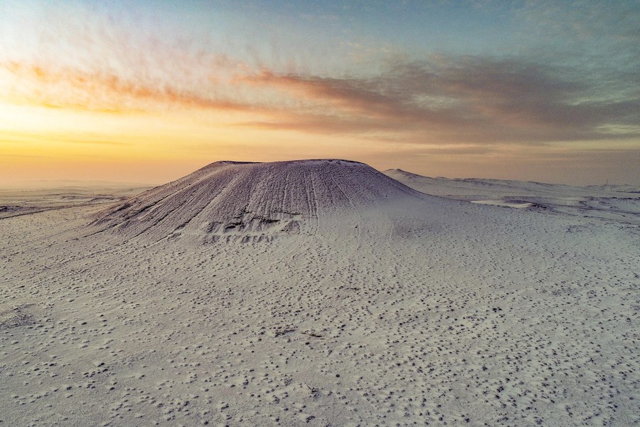
Aerial photo taken on Nov. 28, 2020 shows the scenery of snow-covered volcanoes in Ulanqab, north China's Inner Mongolia Autonomous Region. (Photo by Wang Zheng/Xinhua)
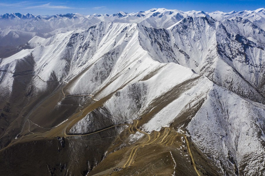
Aerial photo taken on May 1, 2020 shows a winding road on mountains in Yecheng County, northwest China's Xinjiang Uygur Autonomous Region. (Xinhua/Hu Huhu)

Aerial photo taken on Sept. 23, 2020 shows a view of Caka Salt Lake in Wulan County, northwest China's Qinghai Province. (Xinhua/Zhang Long)
Aerial photo taken on Oct. 12, 2020 shows the autumn scenery of Daqinggou national reserve in Horqin Left Wing Rear Banner of north China's Inner Mongolia Autonomous Region. (Xinhua/Liu Yide)

Aerial photo taken on May 13, 2020 shows fishing boats inside a bay at Beijiao Village in Lianjiang County, southeast China's Fujian Province. (Xinhua/Jiang Kehong)

Aerial photo taken on Nov. 26, 2020 shows the sunset scenery in Sansha Town, Xiapu County of southeast China's Fujian Province. (Xinhua/Song Weiwei)

Aerial photo taken on Nov. 7, 2020 shows a view of the Lushan Xihai Lake in Jiujiang, east China's Jiangxi Province. (Xinhua/Zhou Mi)
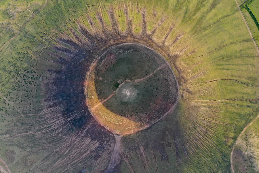
Aerial photo taken on July 29, 2020 shows a volcano of the Ulanhada volcano cluster in Qahar Right Wing Rear Banner of Ulanqab, north China's Inner Mongolia Autonomous Region. (Xinhua/Liu Lei)
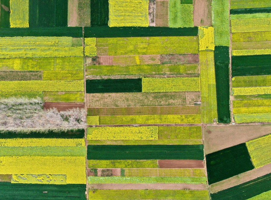
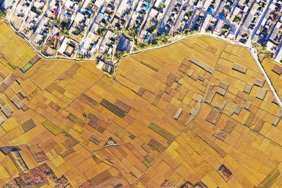
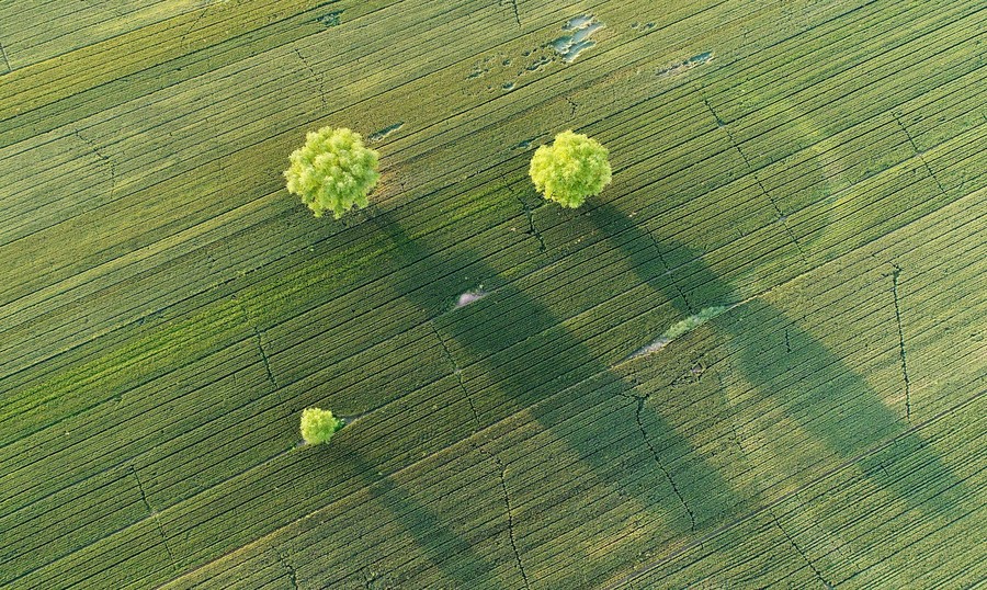
Aerial photo taken on March 30, 2020 shows fields in Maozhuang Village, Huaibin County of central China's Henan Province. (Xinhua/Li An)
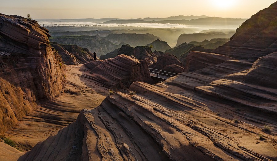
Aerial photo taken on Sept. 24, 2020 shows the scenery of Danxia landform scenic area in Longzhou Town of Jingbian County, northwest China's Shaanxi Province. (Xinhua/Tao Ming)
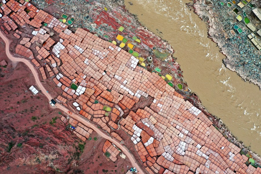
Aerial photo taken on May 4, 2020 shows salt pans in Naxi Township of Mangkam County, southwest China's Tibet Autonomous Region. (Xinhua/Wang Zehao)

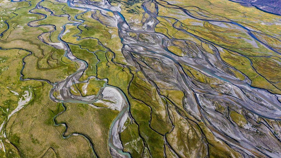
Aerial photo taken on June 17, 2020 shows the scenery of Raqu River in Ruoergai County, southwest China's Sichuan Province. (Xinhua/Liu Kun)
Aerial photo taken on May 26, 2020 shows the rural scenery at Neiqiu Town of Xingtai City, north China's Hebei Province. (Xinhua/Zhu Xudong)
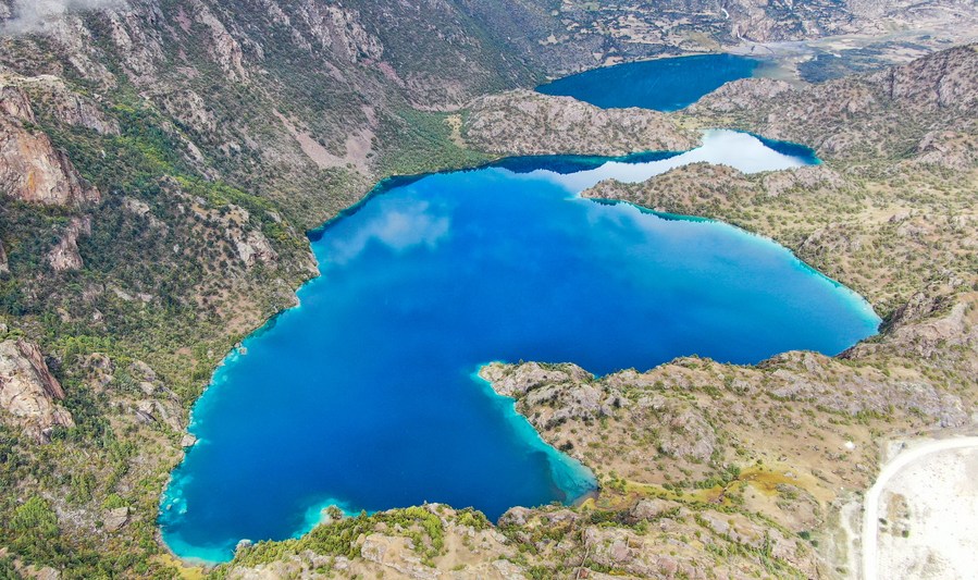
Aerial photo taken on Sept. 26, 2020 shows the "black lake" of the "three-colored lakes" in Puyu Village of Banbar County, Qamdo, southwest China's Tibet Autonomous Region. (Xinhua/Jigme Dorje)

Aerial photo taken on May 15, 2020 shows a farm machinery seeding in cole flower fields in Menyuan Hui Autonomous County, northwest China's Qinghai Province. (Xinhua/Zhang Hongxiang)
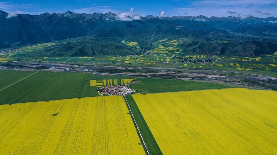
Aerial photo taken on July 22, 2020 shows the scenery of cole flower fields in Menyuan Hui Autonomous County, northwest China's Qinghai Province. (Xinhua/Wu Gang)■
