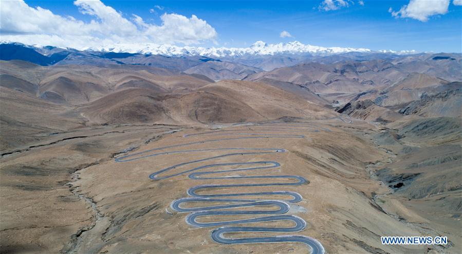
Aerial photo taken on May 18, 2017 shows a road leading to Mount Qomolangma in southwest China's Tibet Autonomous Region. According to the white paper "Democratic Reform in Tibet -- Sixty Years On" issued in March of 2019, by the end of 2018, Tibet had 97,800 km of highway, 660 km of which were high-grade highways. All counties in Tibet had access to highways, and of the 697 townships and towns, 579 had direct access to highway transport and 696 could be reached by highways. Of the 5,467 villages in Tibet, 2,624 had direct access to highway transport and 5,457 could be reached by highway. In 2006, the Golmud-Lhasa section of the Qinghai-Tibet Railway was completed and opened to traffic, which was the first railway in Tibet. In 2014, the construction of Lhasa-Shigatse Railway was completed and tracklaying started on the Lhasa-Nyingchi Railway. (Xinhua/Purbu Zhaxi)